How difficult it would be to associate social class with addressing system. That is Bogotá.
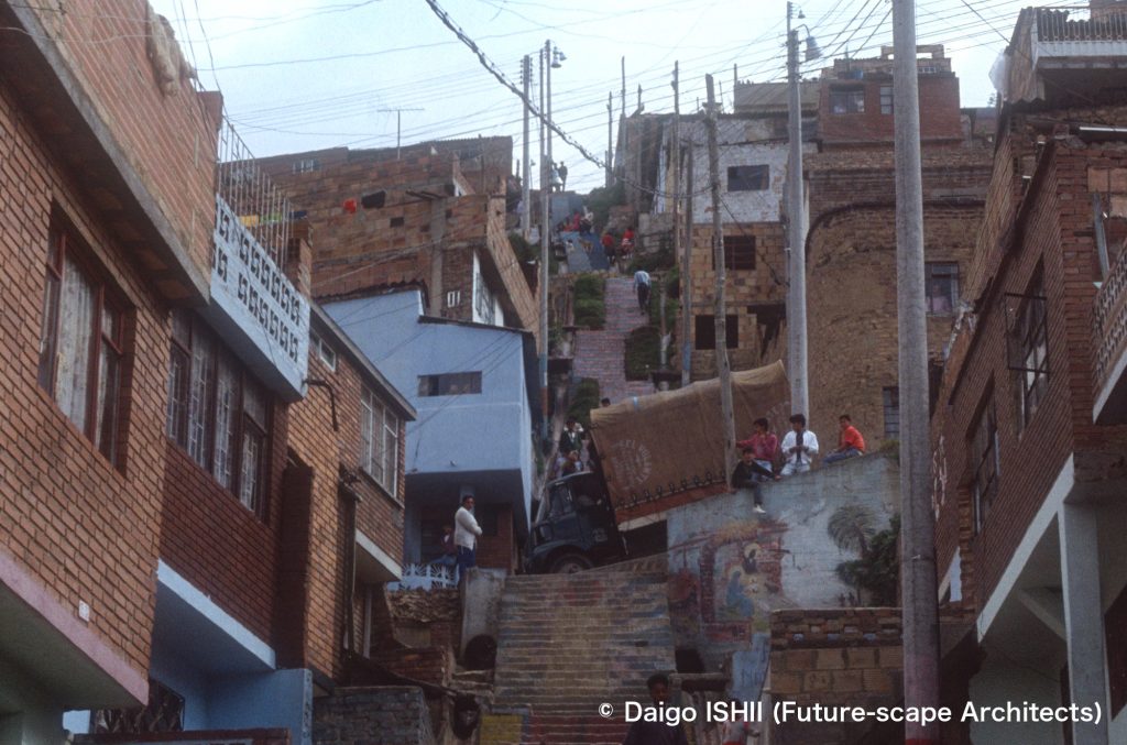
Sur (South District) : See the townscape of Sur. Houses overlap on steep slopes, and steep stairs connect plains and the top of the hill.
https://goo.gl/maps/5EAtREmAFWUbVTkB7
The city of Bogotá is 30 km north-south and 20 km east-west and is divided into grids by
Carrera : streets running north-south
Calle : streets running east-west
The city numbered the streets. Calle started from Calle 1st and Carrera from Carrera 1st in Centro (downtown).
When I lived there, Calle extended to 170th in Norte (North), 90th south in Sur (South). "South" is added to the end of the Calle number in Sur as Calle 50th Sur to distinguish from Calle in Norte
Meanwhile, Carrera extended to 130th in the west . The area located on the east side of the city is mountainous, so there is almost no urban area. Only a small part of the new urban area on the slope was displayed like Carrera No. 3 Este (East) by adding Este at the end of the Carrera number.
Due to the expansion of the city, twisted parts had appeared, but the city forced them to fit in the matrix of numbers.
If a house is located on the 12th lot on Carrera 7th, counting from the intersection with Calle 5th street, the address is 'Carrera 7th, 5-12'. It was just the coordinates. This coordinated addressing system became a matrix that reflected the social structure.
The top of the coordinates was Chico districts of Norte, where Calle 90th and Carrera 11th intersect. Starting from the top as the reference point, social class descended like contour lines as the numbers moved north-south or west. The original center of the city, Centro (Downtown), has declined, and, in Sur (South District) beyond Centro, the depression was outstanding. If you asked the coordinate points in the address of someone, you could roughly estimate from his/her social class to the income level, even in places you had never been, based on the number difference with the reference point. So, to say your address is to reveal your social class. Estrato's system emphasizes it. The city was divided into 6 layers called Estrato, and the difference in electricity and water charges between the lowest layer and the highest layer was more than 10 times.
A friend of my friend, who was a shopkeeper in Sur, saved his money and rented a small room in Norte, where the upper class lived. After having sent her daughter to school from there and having married a young man from Norte, he canceled his apartment and returned to Sur.
The Spanish Law of the Indies established this grid block system during the colonial period. Six hundred years later, the hierarchies that the Laws of the Indies structured still cast a shadow over the city of Bogota.
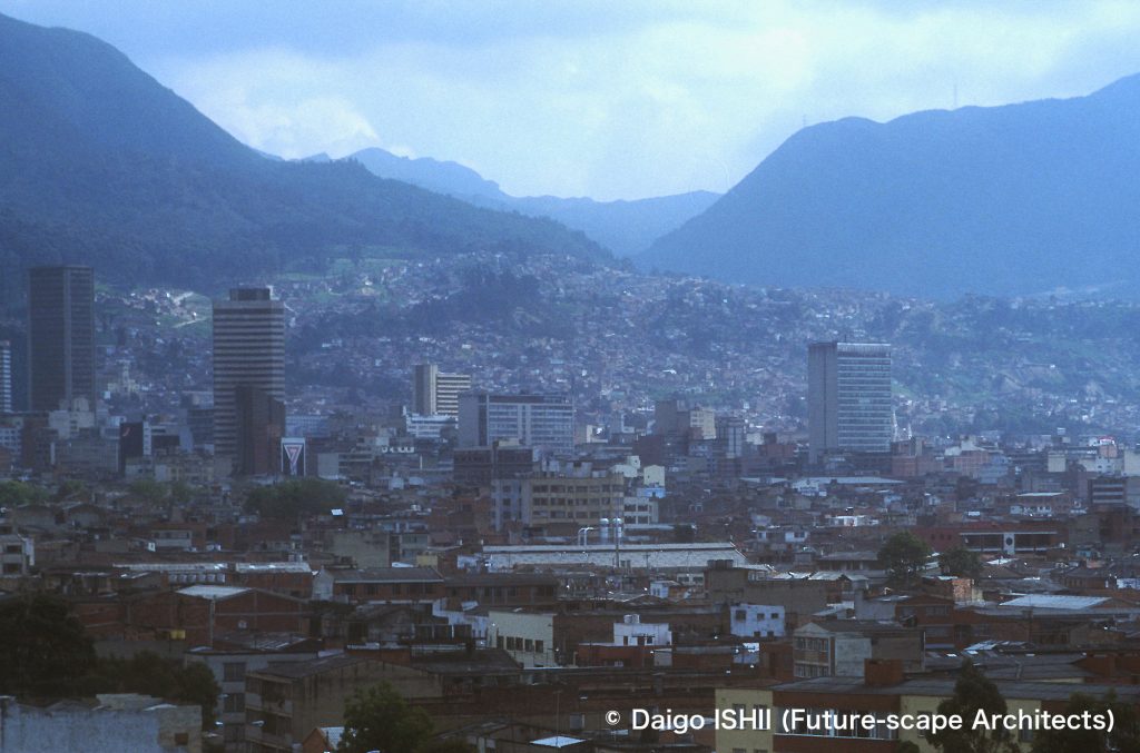
https://goo.gl/maps/YH5PXwi3WKc5ig6Y8
Sur (South District)
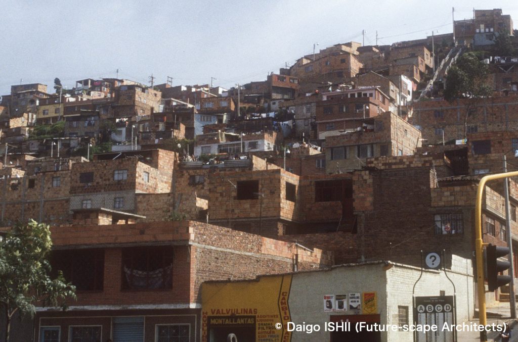
Sur (South District) : See the townscape of Sur. Houses overlap on steep slope.
https://goo.gl/maps/5EAtREmAFWUbVTkB7
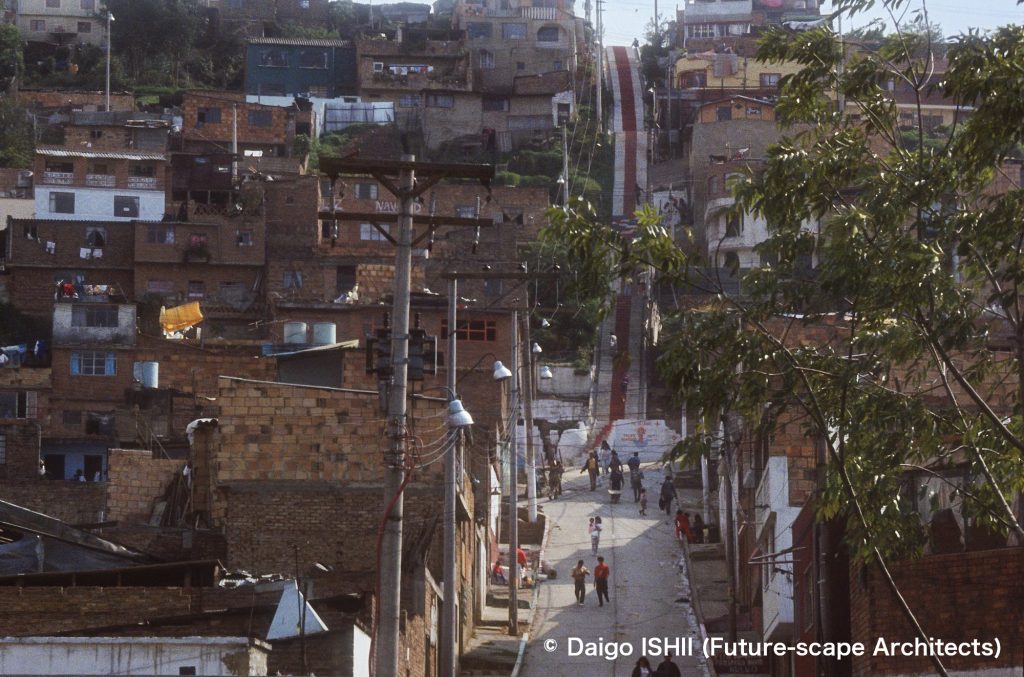
Sur (South District) : See the townscape of Sur. Houses overlap on steep slopes, and steep stairs connect the main street and the top of the hill in a straight line.
https://goo.gl/maps/tazqWyGFKtgqvVBU8
https://goo.gl/maps/5EAtREmAFWUbVTkB7
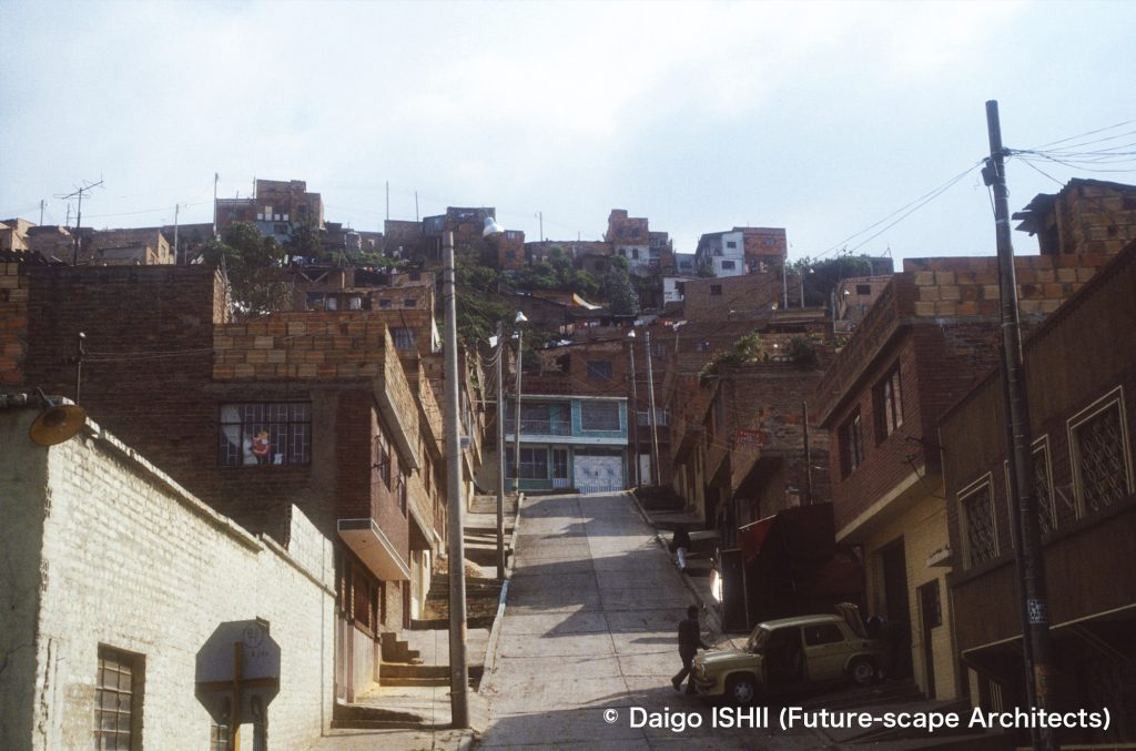
Sur (South District) : Compared with the street views of 2018 and 2020 on Google Maps with photos taken in the 1990s, the townscape in 2018 was not much different from the 1990s, but, in the townscape in 2020, the exterior wall of many houses was painted with white paint on the previous exposed bricks. The change during 2 years would be a manifestation of economic development in Colombia ?
https://goo.gl/maps/h6S5SvTpzaw1PU8c9 (Street view in 2018.11)
https://goo.gl/maps/Cb3ywVKxHykzKSbF9 (Street view in 2020.03)
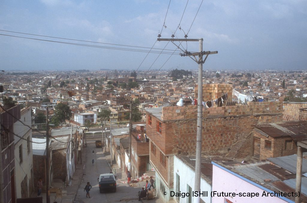
Sur (South District) : Overlook the townscape from the hill. In the house at the right-center on the photo, the bricks facing the neighboring house that are difficult to see use large base bricks, meanwhile the part facing the road uses small finishing bricks.
https://goo.gl/maps/5EAtREmAFWUbVTkB7
Centro (Downtown)
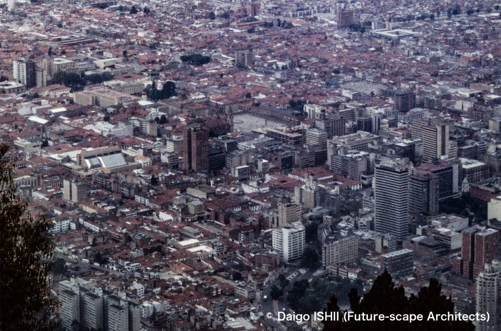
Centro (Downtown) : The square in the center of photo is Plaza Bolivar, the historic center of Centro. Starting from the Plaza, grid blocks were set up under the Spanish Laws of the Indies during the colonial period. This area is neatly laid out in a grid pattern.
https://goo.gl/maps/pBphUjbWq7Y7NB9H7
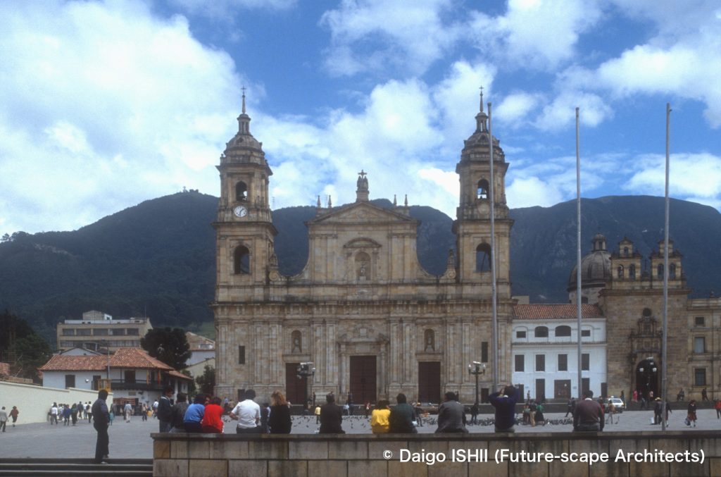
Centro (Downtown) : See Plaza Bolivar and the Catedral Primada de Colombia facing the plaza, in the center of Centro. The cathedral was constructed at the beginning of 19the century on the site where the first cathedral had been constructed in 1539.
https://goo.gl/maps/j8jPvJTMwpbQBG1r8
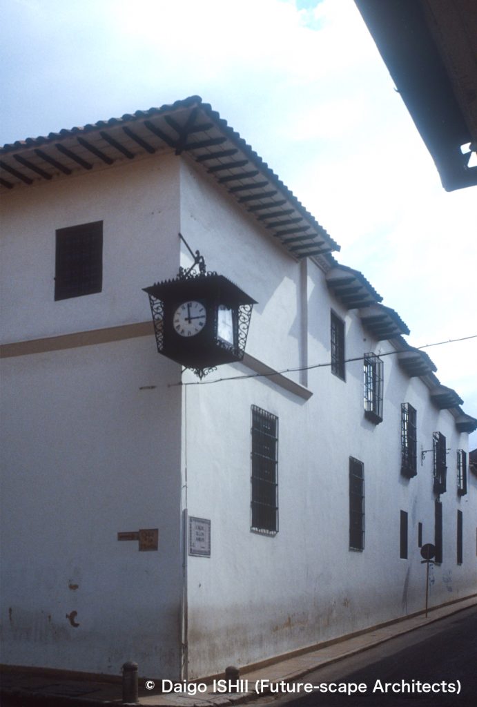
Centro (Downtown) : See the historic district in Centro.
https://goo.gl/maps/8erMT8Ac6AjmrFf4A
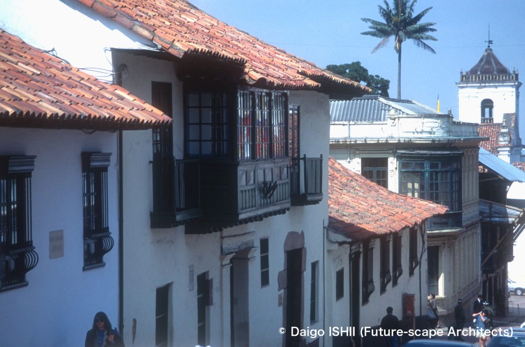
Centro (Downtown) : See the historic district in Centro.
https://goo.gl/maps/ry4APM3YWjLAEPqTA
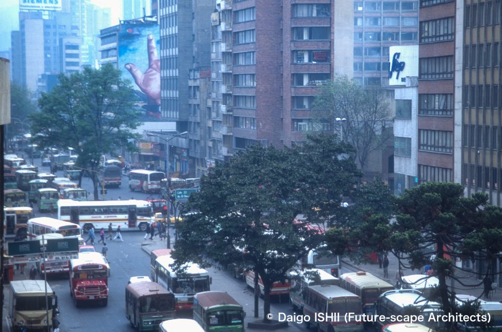
Centro (Downtown) : See the streetscape on Carrera 10th street that was the traffic tank running through Centro.
https://goo.gl/maps/F6r2ApYNStt1Zrbc9
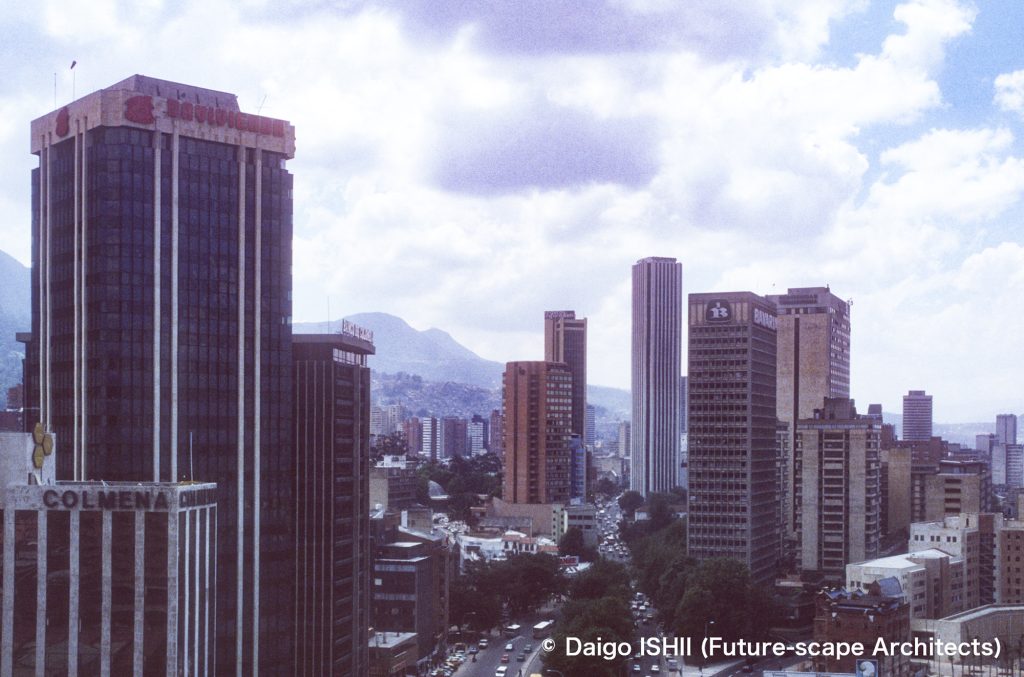
Centro (Downtown) : See toward the center of Centro from the business district that extends to the north end of Centro. The central boulevard is Carrera 7th street as Bogota's main street. The tall building in the center is the Torre Colpatria, which opened in 1979 and was the tallest skyscraper in Colombia until 2016. It has 50 floors and a height of 196m.
https://goo.gl/maps/cBKVSrGTrycj7C83A
Tesaquillo
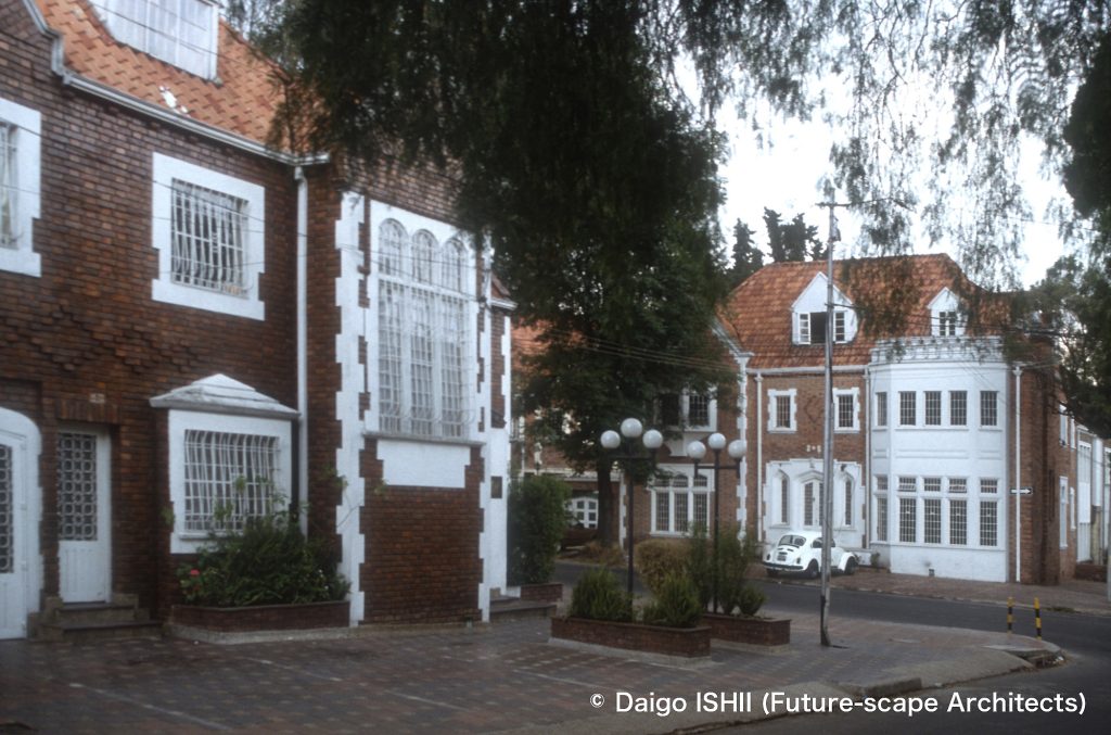
Halfway between Centro and Norte : See Tesaquillo, then a suburban residential district developed in the early 20th century. It is located between Centro and Norte. From there to the north where Chapinero is located, the Victorian houses of the time, which were inhabited by upper-class citizens who had moved from the center of Bogotá, extensively remains. Chapinero is dotted with stylish restaurants and shops that use historical architecture in residential areas.
https://goo.gl/maps/PYmK9oiSLvYWesHn7
https://goo.gl/maps/aU49jY6R87CfhDRNA
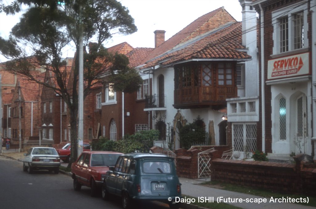
Halfway between Centro and Norte : See Tesaquillo, then a suburban residential district developed in the early 20th century.
https://goo.gl/maps/PYmK9oiSLvYWesHn7
https://goo.gl/maps/MmmYqqCa6GPLT4pE8
Norte (North District)
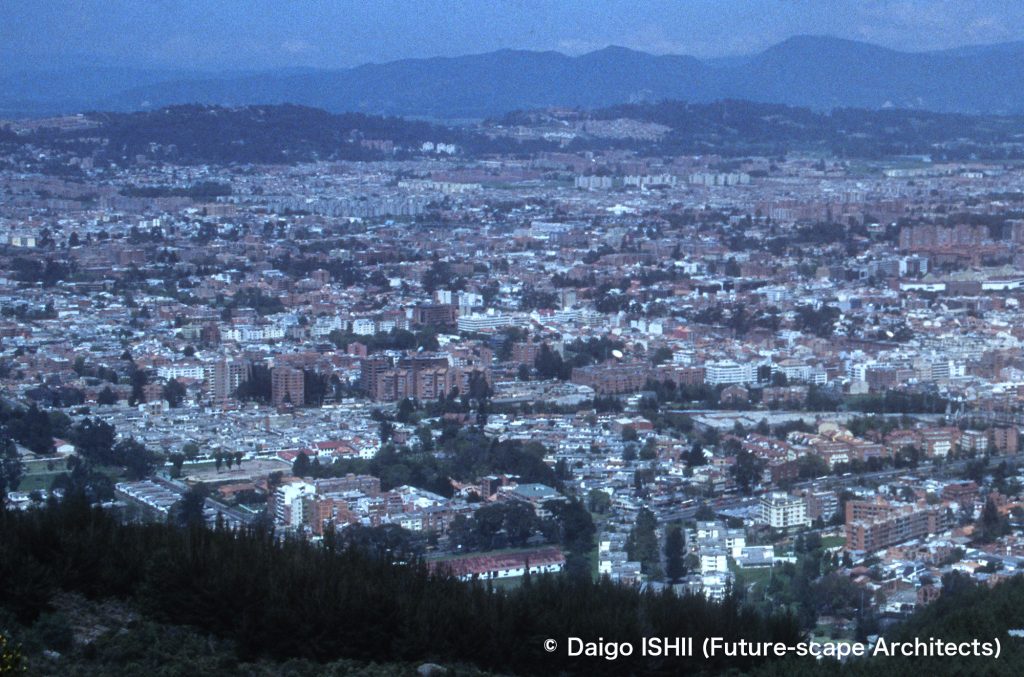
Norte (North District) : See residential areas in Chico under the forest.
https://goo.gl/maps/oYM1p4dFvcUdLPUp8
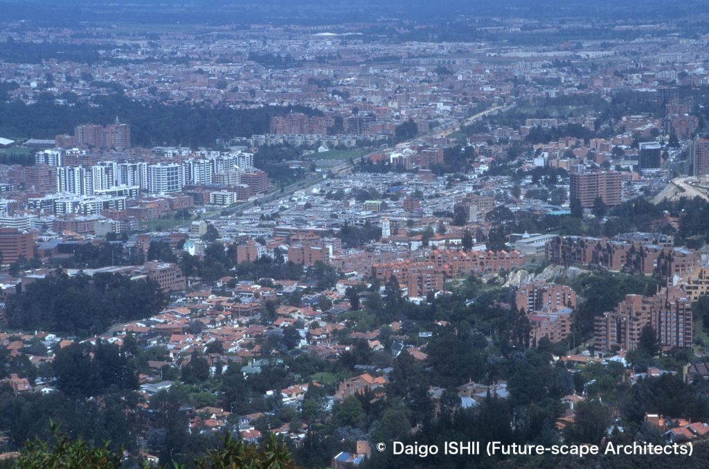
Norte (North District) : Overlook residential areas in Norte, adjacent to Chico, from a hill. Usaquen, one of the greenest residential areas in Bogota, is the foot of the hill.
https://goo.gl/maps/W48JeMko2LvGW3Ui6
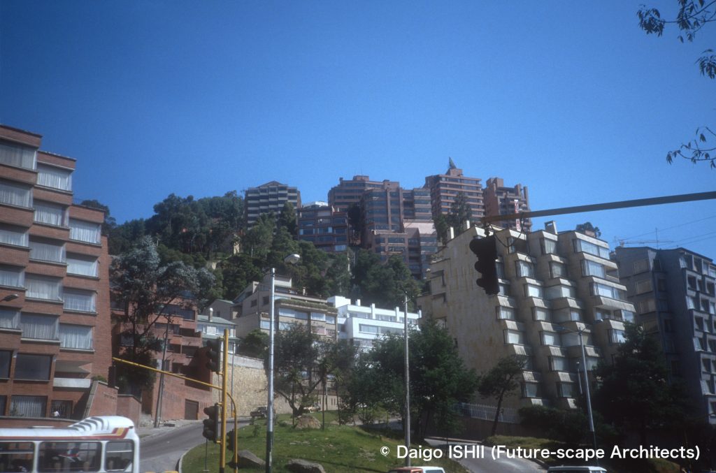
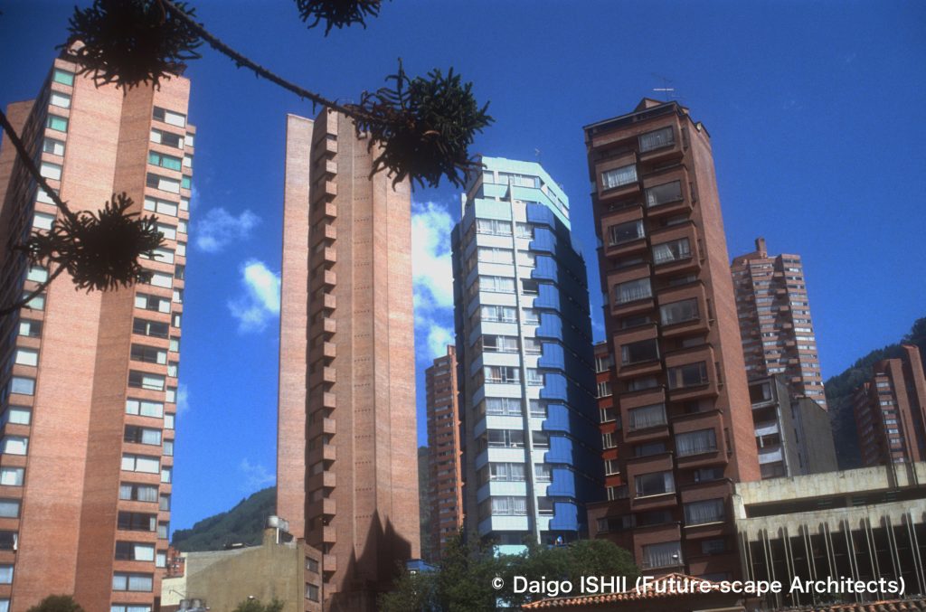
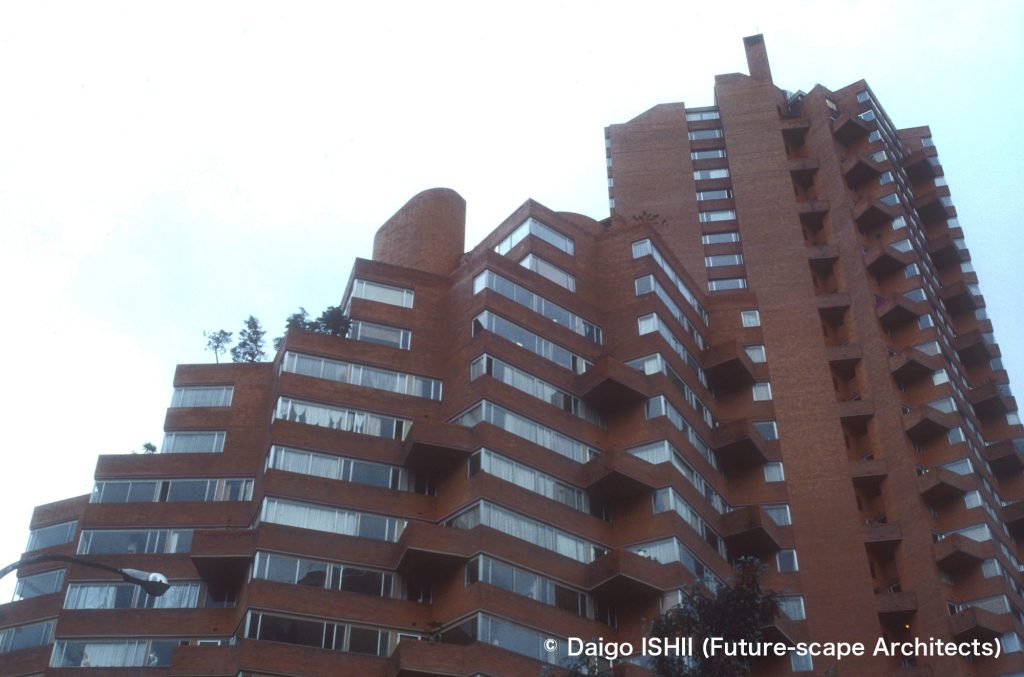
Norte (North District) : Look up luxury condominiums on the slope of the mountain side from the intersection of Carrera 7th as the thoroughfare of Bogotá in the upper class district of Norte. The back side of the shooting point is the Chico district, the highest-class residential area.
https://goo.gl/maps/cMcCXcUtyxCDAAWu6
Western District
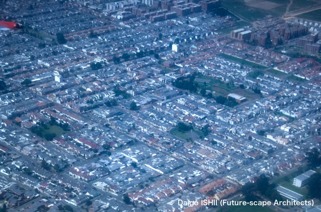
Western District : See middle class detached residential area.
https://goo.gl/maps/oY12vPUwb8JtGPBK9
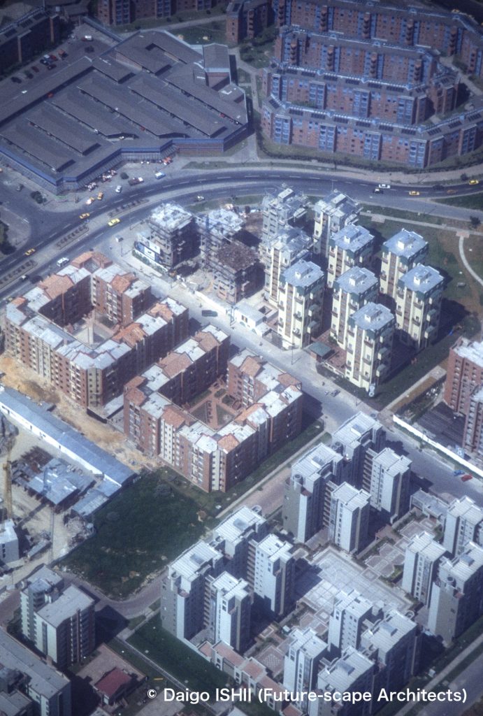
Western District : See an area where large-scale housing complexes for the middle class have been developed.
https://goo.gl/maps/jP8HGB1C2FLEKRXW9
Click here for your impressions
reference
Wikipedia
Please do not use or upload our photos without permission.
